
Roadtrip 2017 – Exploring The West – Day 4 – July 14th:
I woke up cold a few times in the night. Ouray Colorado is 7,792 feet above sea level, and it gets down into the 40’s at night. Even in mid-July. My sleeping bag was rated at 40 degrees, but that didn’t keep my head from getting cold. I have a deep sleeping bag, and tried to slide my head down into it, but then I felt like I was going to suffocate myself. I also worried about Marley getting cold, so I let him sleep on the mattress next to me, and tried to cover him with some of my sleeping bag.
As morning came, I woke up, took Marley for a walk, and then headed down to the bath house for a shower. On my way back to camp, I met a Jeep owner from Texas, and we talked a while about Texas, Colorado, and the various trails in the area. He recommended that I get the book ‘Guide To Colorado Backroads & 4-Wheel Drive Trails‘

After I returned, I broke out my Coleman stove and a skillet, and cooked up some pancakes and bacon. I made a few extra pieces for Marley, and poured the bacon grease on his food. After I got everything cleaned up from breakfast, Marley and I headed out to explore the San Juan Mountains.
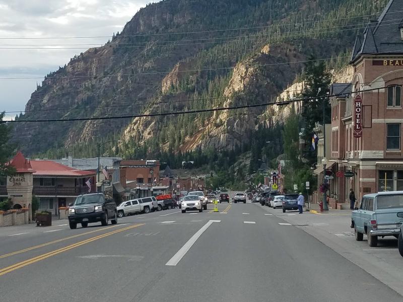
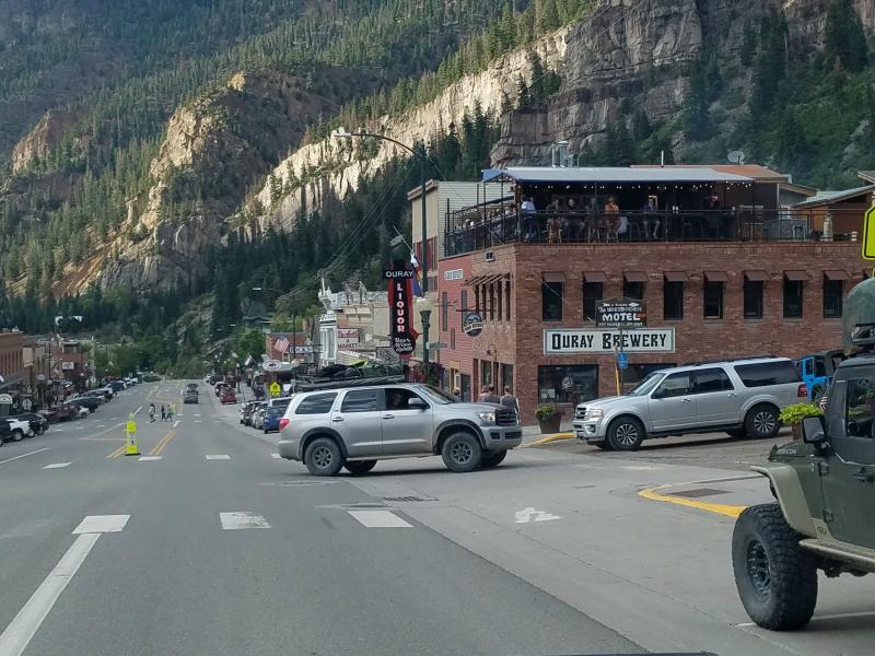
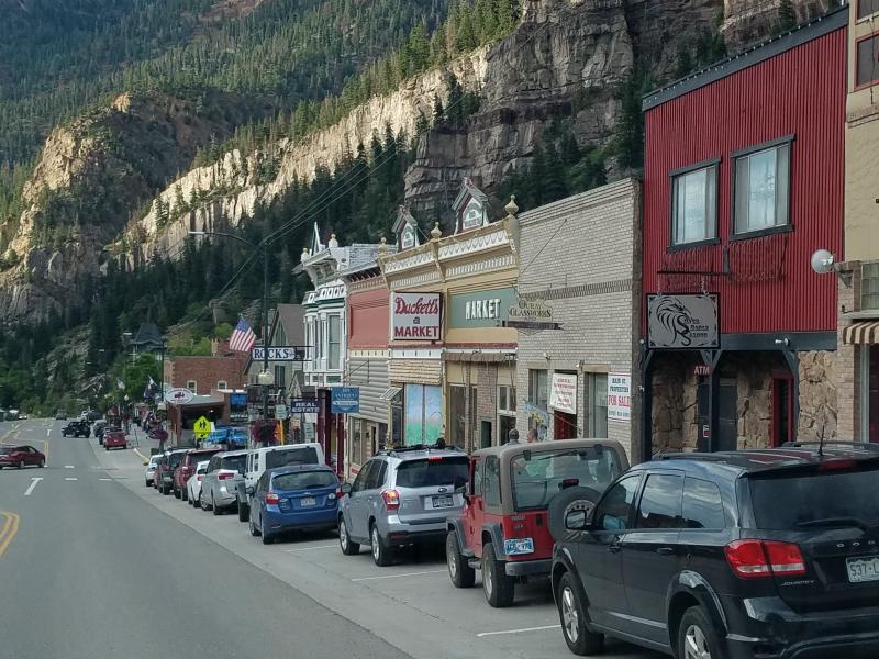
Ouray Colorado: Even though the KOA campground has an Ouray address, it’s north of town, so we hadn’t actually been to Ouray yet. Marley and I left the campground, and headed south on US 550 in to town.
Ouray has been a special destination of world travelers for more than 100 years. This small intimate community is nestled in some of the most rugged and towering peaks of the Rockies. Set at the narrow head of a valley at 7,792 feet and surrounded on three sides with 13,000 foot snowcapped peaks – Ouray is home to hundreds of miles of historic Jeep roads, sulfur-free hot springs with stunning views and the world-famous Ouray Ice Park.
Remarkably, two-thirds of Ouray’s original Victorian structures, are still occupied, and have been lovingly restored in order to preserve their turn-of-the-century charm.
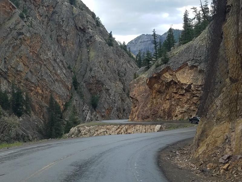
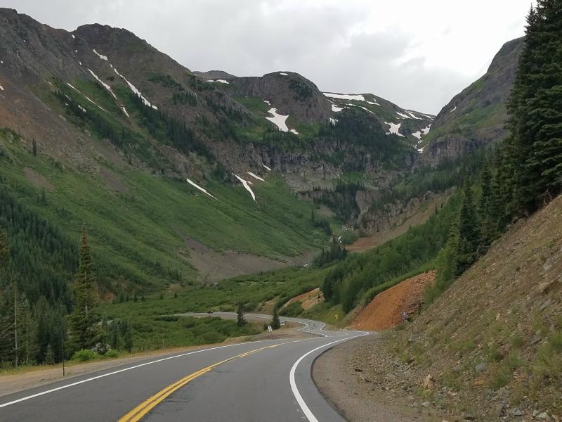
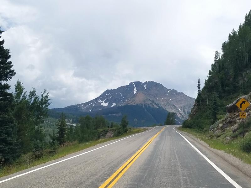
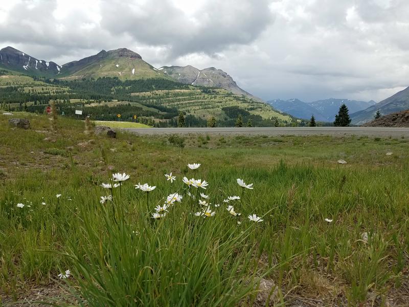
We passed through Ouray and continued south on US 550. The road twists and climbs up above Ouray, and offers a great view of the town.

This section of US 500 is referred to as ‘The Million Dollar Highway’. The Million Dollar Highway stretches for about 25 miles between Silverton and Ouray, Colorado. The road climbs up to (3) very high mountain passes. Coal Bank Pass (10,640 ft ); Molas Pass (10,970 ft) and Red Mountain Pass (11,018 ft).
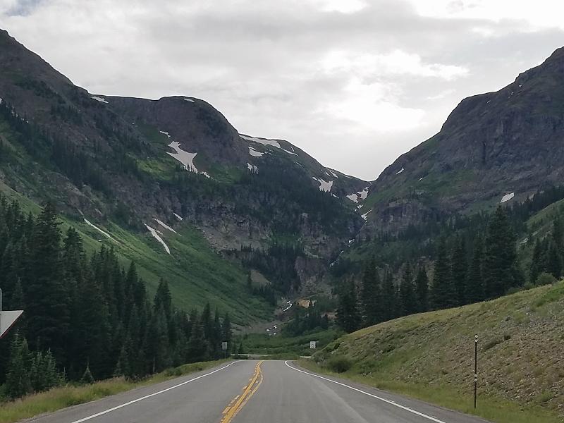
This is a section of road carved out of the side of a mountain, and is literally paved right up to the edge of the cliff. There’s no guardrails to stop you if you make a mistake. You’ll only drive off the edge of the pavement once on this road.
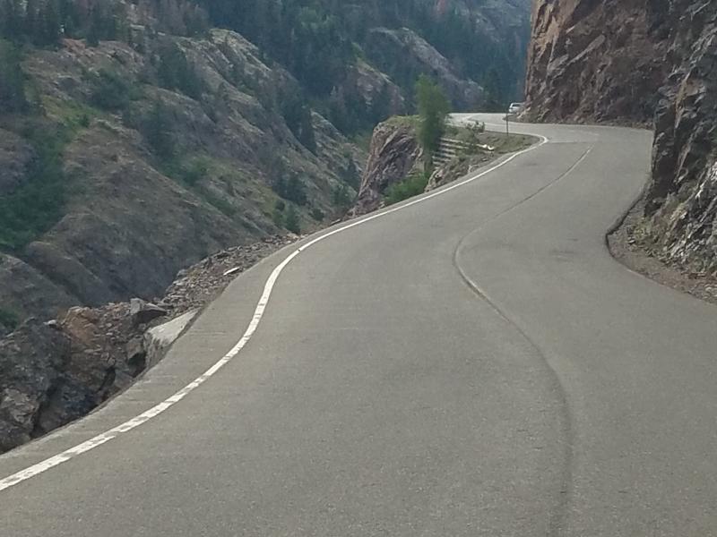
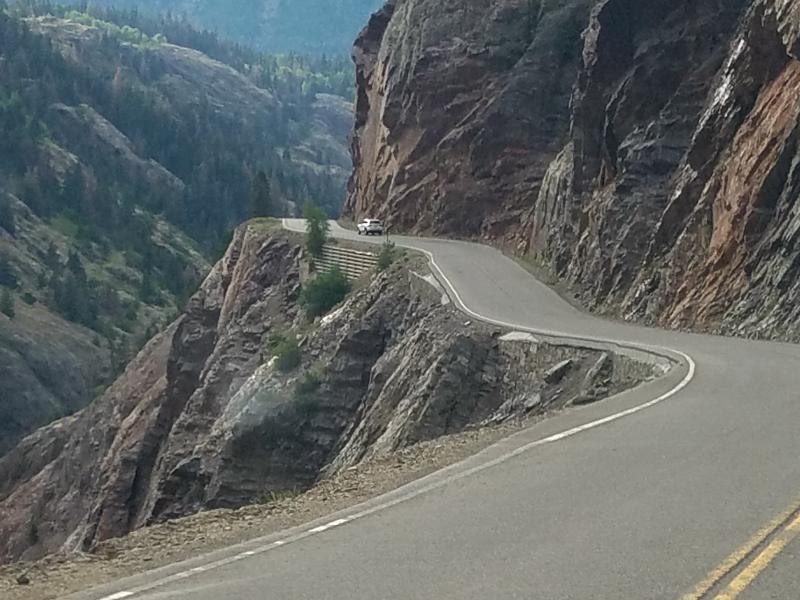
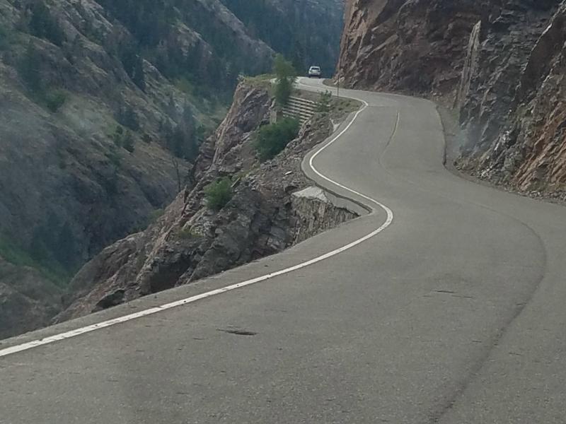
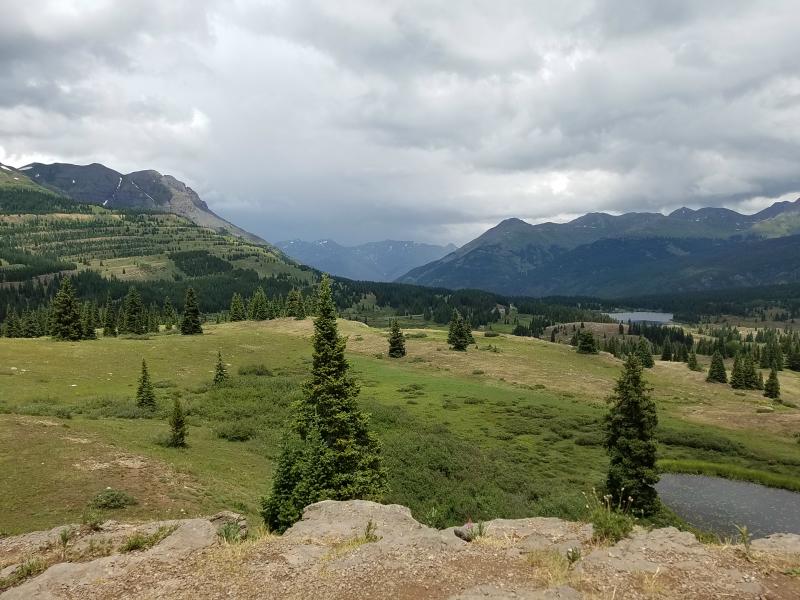
Once you get past this section of US 550, the area widens and offers amazing views.

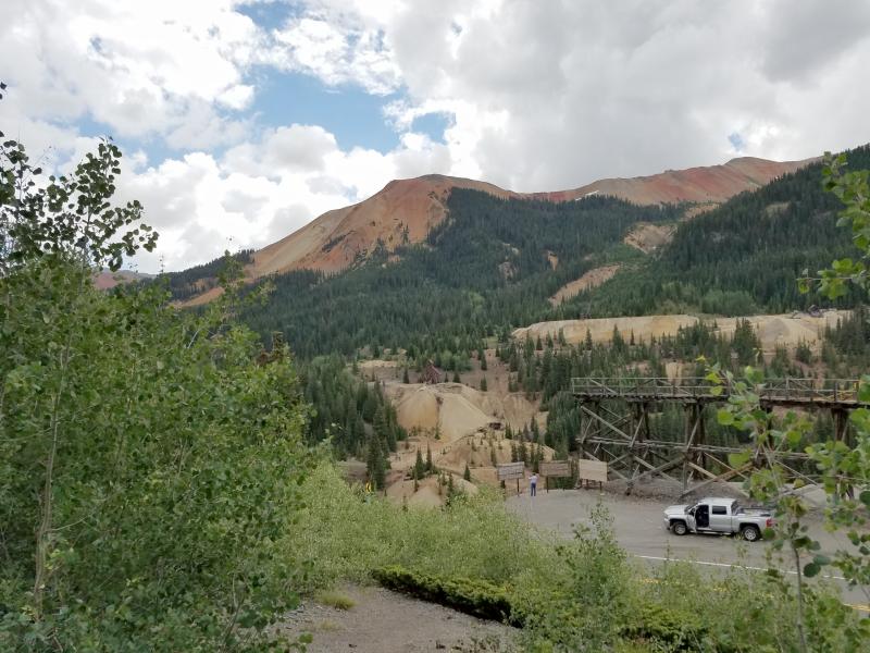
Traveling south on US 550 brought us to the remnants of the Idarado mining town. There’s a couple of old house there, and a place to pull off and park. But the real site to see is the Yankee Mine on the other side of the valley
Do you see it? Let me zoom in a little for you…..
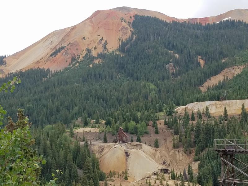
Do you see it now? I really wanted to go over and see it up close. I have a Ford F-350 4×4 pickup with a lift and mud tires. Why should I be looking at this from a paved parking lot?
Knowing that there has to be a road to the mine, I continued south on US 550. After a short drive, I found a dirt road off of the east (left) side of the highway with a small placard marking it as 31. I made the turn and began following the road. The problem with this road (more of a trail..) is that it splits of in different areas without any markings. All I could do was try and pick the best direction, and continue forward.
I found myself needing my 4-wheel drive, and discovered the abilities of my truck off-road. But, I did find the mine, along with some other buildings and great scenery.
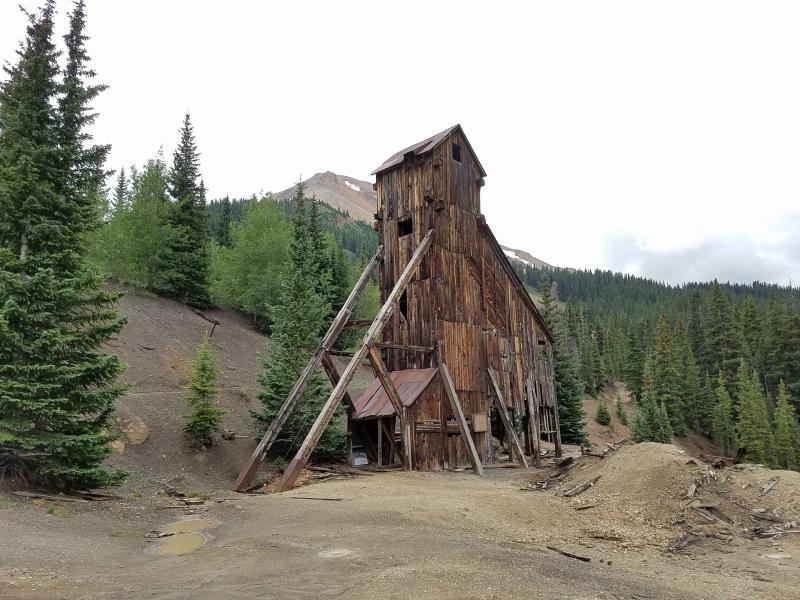
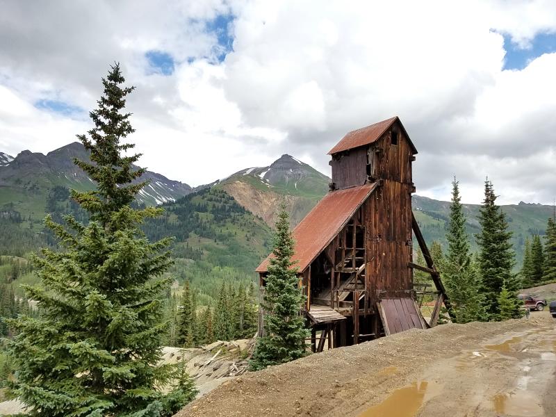
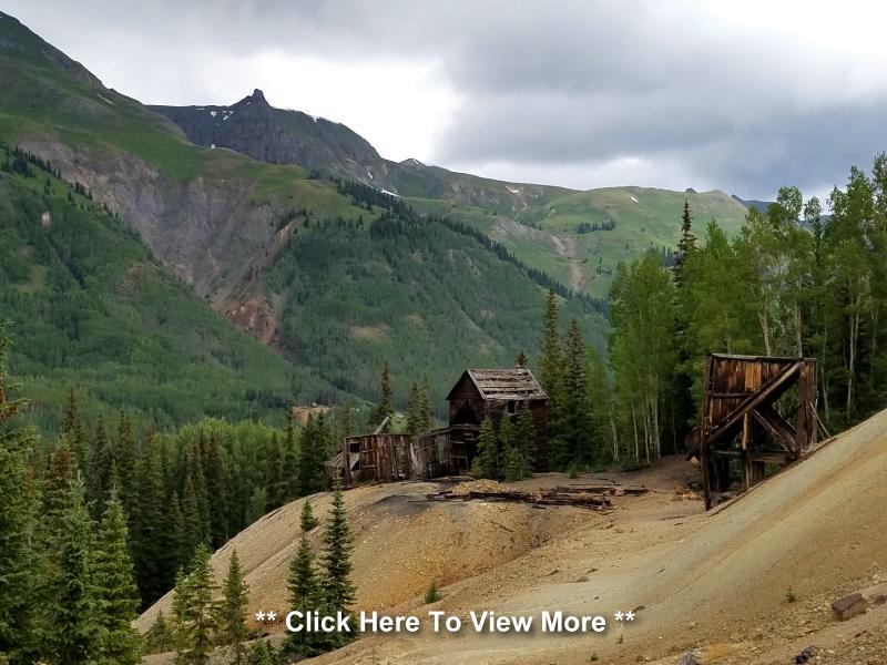
There are to many photos to share of this little side journey, but I encourage you to CLICK HERE (or on the mine photos) to see more photos and details about the Yankee Girl mine area.
After visiting the Yankee Girl Mine, we returned to US 550, and continued south towards Silverton.
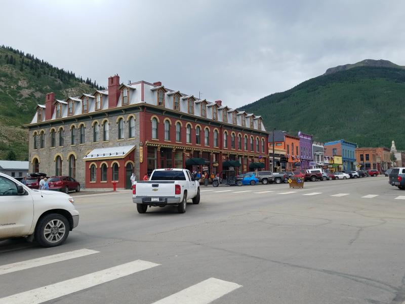
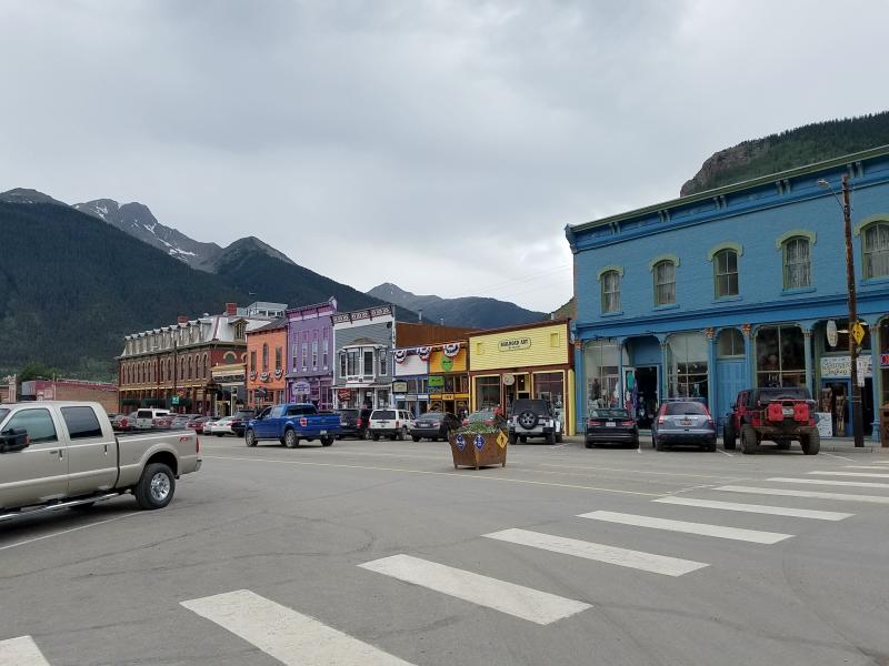
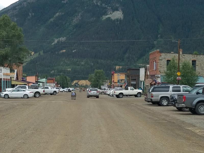
Silverton Colorado: Silverton is a former silver mining camp, most or all of which is now included in a federally designated National Historic Landmark District, the Silverton Historic District. It is the county seat of, and the only incorporated municipality in San Juan County, Colorado.
You can rent Jeeps, ATV’s and side-by-sides in Silverton, and explorer the miles of trails in the surrounding mountains.
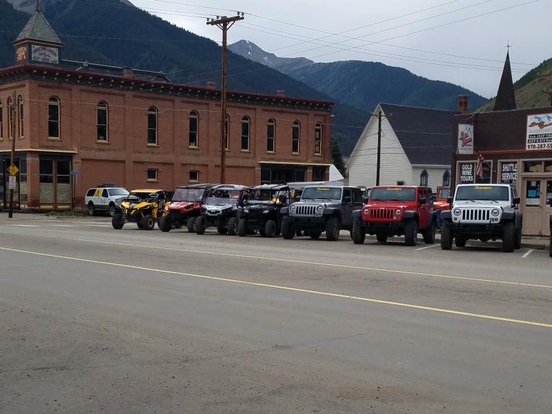
Silverton is also a town where you can drive your all terrain vehicles on the town streets.
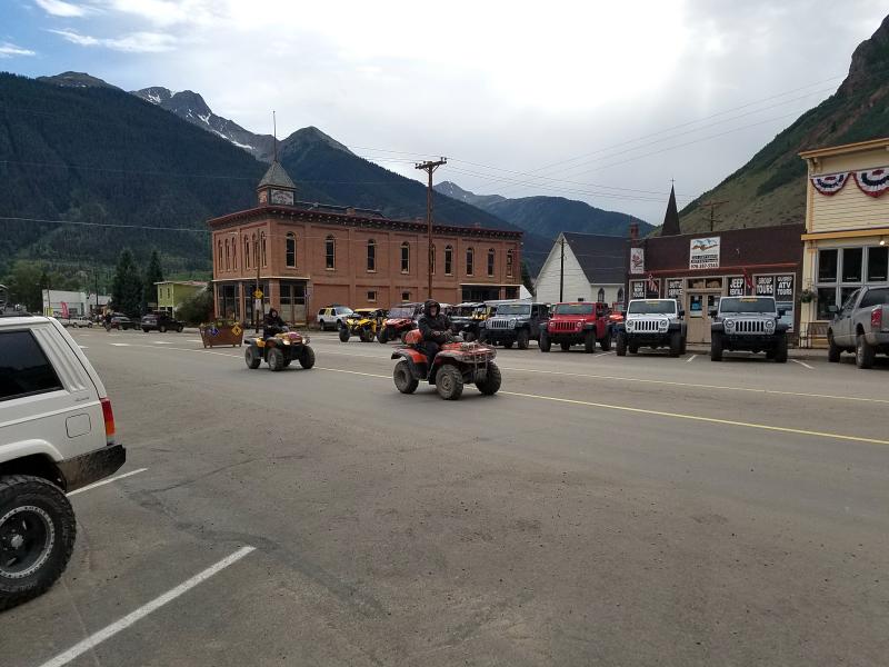
Silverton was a unique town. With the exception of the main road, all of the other streets are dirt.
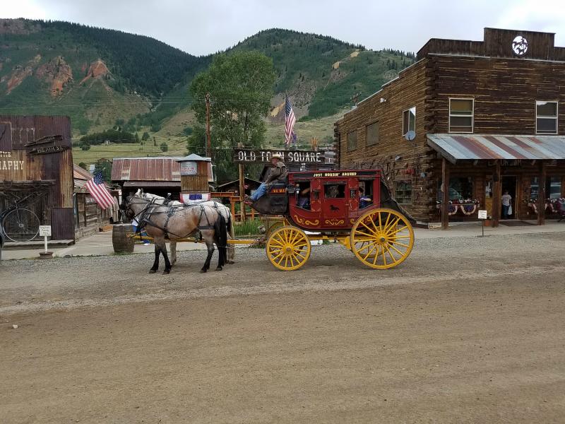
They even have a stagecoach….
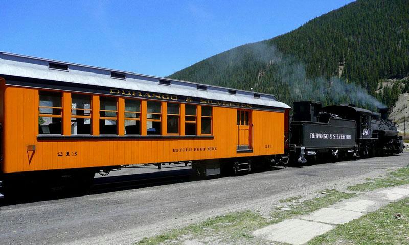
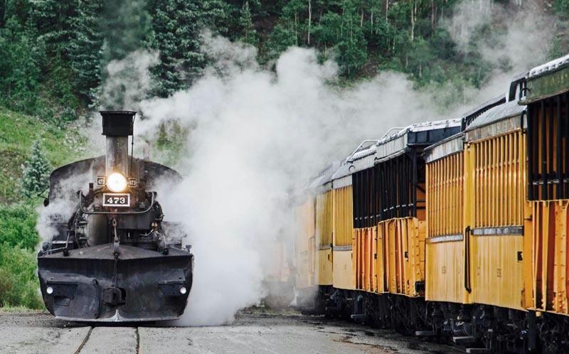
Silverton is linked to Durango by the Durango and Silverton Narrow Gauge Railroad, a National Historic Landmark.
While in Silverton, you can take a ride on the Durango & Silverton Narrow Gauge Railroad (D&SNG). The 3-feet narrow-gauge railroad operates 45.2 miles of track between Durango and Silverton. The railway is a federally designated National Historic Landmark and is also designated by the American Society of Civil Engineers as a Historic Civil Engineering Landmark.
The route was originally opened in 1882 by the Denver & Rio Grande Railway (D&RG) to transport silver and gold ore mined from the San Juan Mountains. The line from Durango to Silverton has run continuously since 1881, although it is now a tourist and heritage line hauling passengers, and is one of the few places in the U.S. which has seen continuous use of steam locomotives. Some rolling stock dates back to the 1880’s.
If you’re bringing your ATV’s to Colorado for a vacation, and want to be able to ride them around town, this is the area you want to stay in.
With the cooler temperatures, I was able to let Marley stay in the truck without worrying about him. I checked out some of the gift shops, and again found myself talking to someone from Texas. This time it was a nice young couple from the southern part of Texas. They too were driving a Ford F-350, but theirs was a dually. Apparently, they had found themselves on a dirt road with one of the dual tires hanging over the edge. It was an interesting story, and probably one that was repeated many times when they got back to Texas.
After checking out the town, and visiting some gift shops, we continued our journey south on US 550.
We went as far as Durango, got some fuel, lunch, and some groceries, and then headed back north to Ouray.
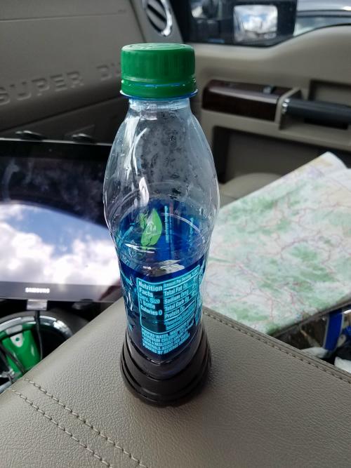
While in Durango, I noticed that my water bottle had crushed from the change in elevations (I had opened it and closed it at a higher elevation). When I drank from the bottle at the higher elevation, the empty part of the bottle filled with air at a lower pressure. As I came down in elevation, the outside air pressure increased. Since the air outside of the bottle was pushing with greater force than the air inside the bottle, the bottle crushed.
I thought it was interesting. I shared it with my daughter, but with her experience as a flight attendant, she’s already seen this on many occasions. She wasn’t as impressed 🙁
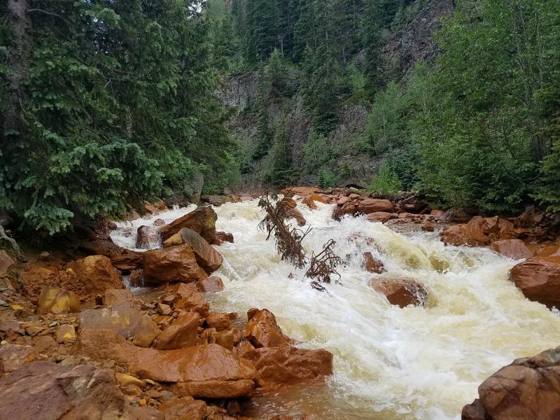
Along the way back, I stopped and took some photos of the Red Mountain Creek along US 550 near Hendrick Gulch.
Arriving back at camp, I lit the charcoal grill and made dinner. Dinner consisted of smoked sausage, and macaroni salad. After that, Marley and I relaxed next to a campfire, before finally turning in for bed.
Tomorrow we’ll be going to Telluride…….
Links:
Roadtrip 2017 – Exploring The West – Main Page
Click HERE to see more photos and information about the Yankee Girl Mine area.
Roadtrip 2017 – Exploring The West – Day 5 – July 15th
About The Author
Growing up, my father always believed that every family needed a truck—there’s just something about having a vehicle capable of hauling anything at a moment’s notice. That philosophy stuck with me, and it’s been the foundation of my lifelong passion for Ford trucks.
While I’m best known for my work with Ford Rangers, I’ve owned a wide variety of Ford trucks over the years—including F-150s, F-250s, F-350s, and even larger rigs like the Ford Excursion, Ford Expedition, and a 1982 Ford Econoline Sportsmobile camper van. I’ve used these vehicles for everything from family transportation to towing car trailers and campers, and each one has fueled my love for Ford’s versatility and durability.
I especially enjoy the styling of 1970s and 1980s Ford trucks—the bold designs, rugged presence, and classic charm are timeless. Sharing my passion for Ford trucks, vans, and SUVs with other enthusiasts online brings me a great deal of joy, and it’s why I created Blue Oval Trucks.
This website is dedicated to helping Ford truck enthusiasts explore, learn about, and celebrate these incredible vehicles. While I share my expertise and experiences here, Blue Oval Trucks is an independent enthusiast site and is not affiliated with Ford Motor Company.